Skip to content

My maps

Mapping involves making choices and offering a reasoned interpretation of space. My maps do more than simply depict a territory: they offer an interpretation of it, based on rigorous analysis, to make complex issues accessible.

Personal work

Map: water in the Middle East

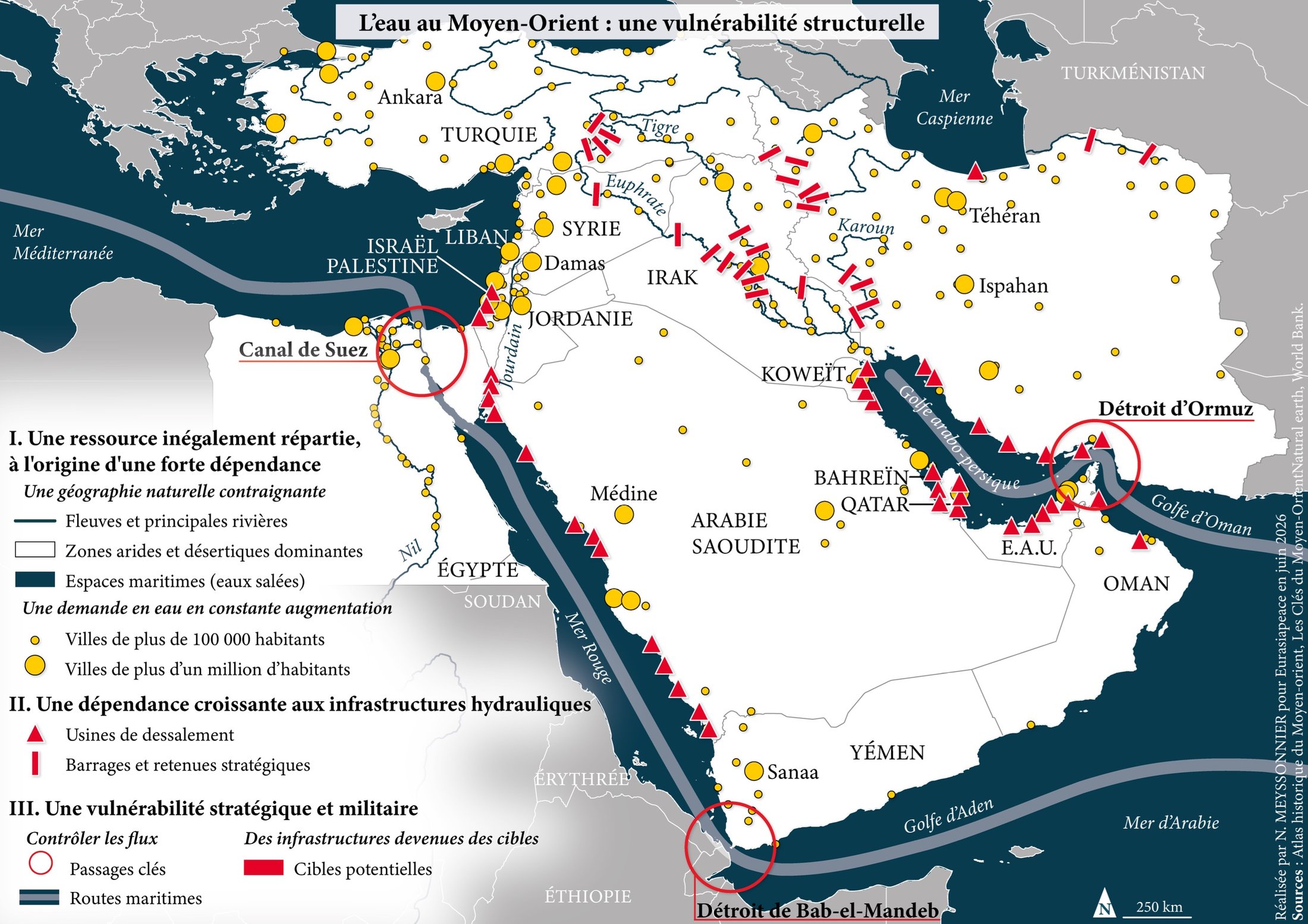
Water in the Middle East: a structural vulnerability

Map produced for the annual review of the Eurasiapeace think tank.

As one of the world’s driest regions, the Middle East regards water as a resource that is both vital and strategic. The sharing of major transboundary river basins (the Tigris, Euphrates, Jordan and Nile) pits upstream states, which control the flow through their dams, against downstream states, which depend on it. Driven by climate change and demographic pressure, this water stress is becoming a factor in vulnerability and rivalries, which this map seeks to analyse.
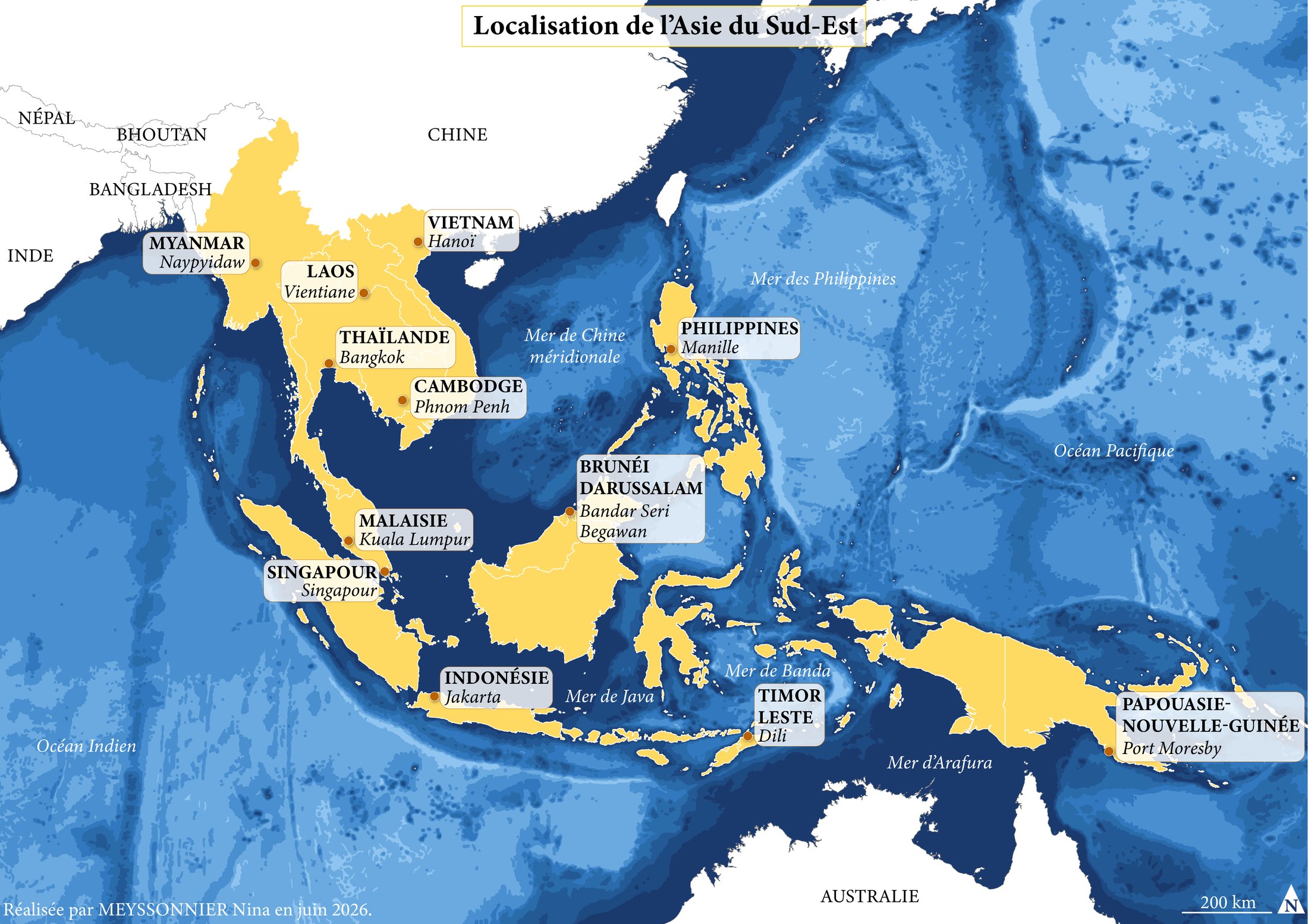
Map: location of Southeast Asia
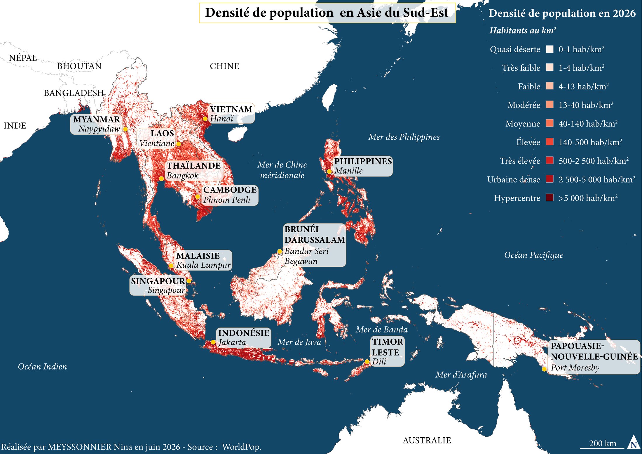
Map: population density in Southeast Asia
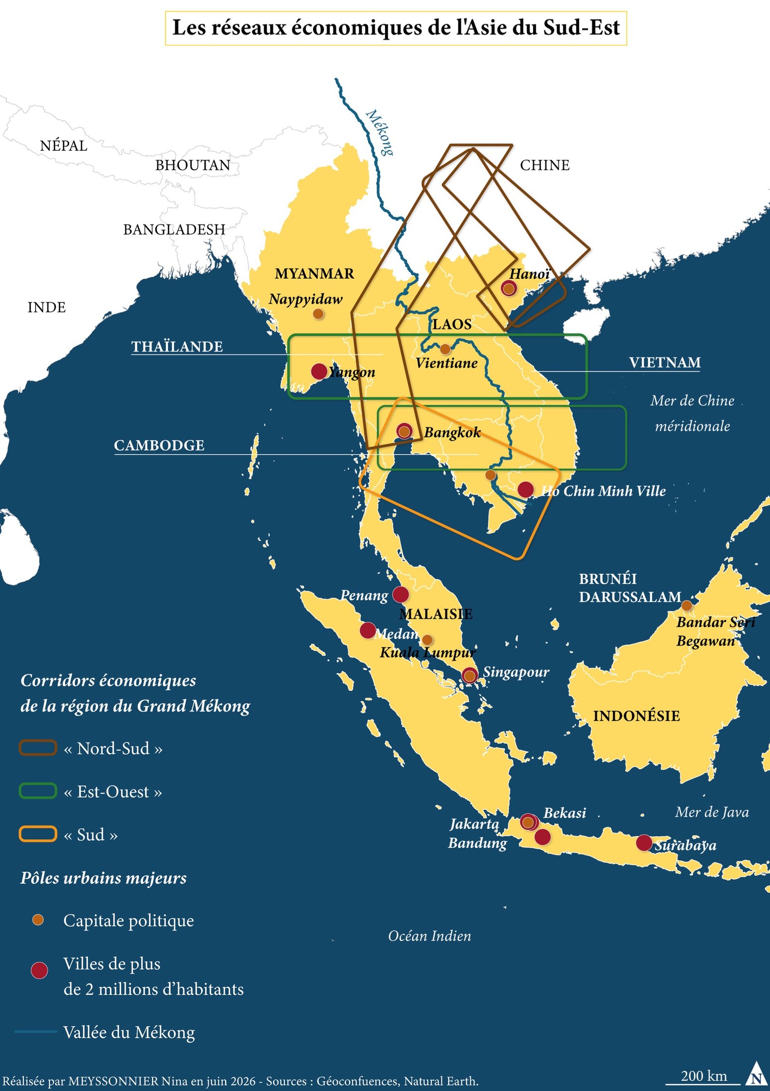
Map: Southeast Asia’s economic networks

Southeast Asia in three maps

A series of three maps created for the annual magazine of Classe Internationale, in collaboration with Aloïs Valade, as part of a partnership with the student associations of the French Institute of Geopolitics (IFG) and the Master’s Programme in International Relations and International Action (MRIAE).

This work accompanies an article focusing on Southeast Asia. The three maps locate and represent different sets of data related to the topic, helping to make the subject easier to understand while illustrating its main issues. Designed to complement one another, they provide a cartographic perspective on the information developed in the article.

Learn more

Map: the demarcation line in the Jura

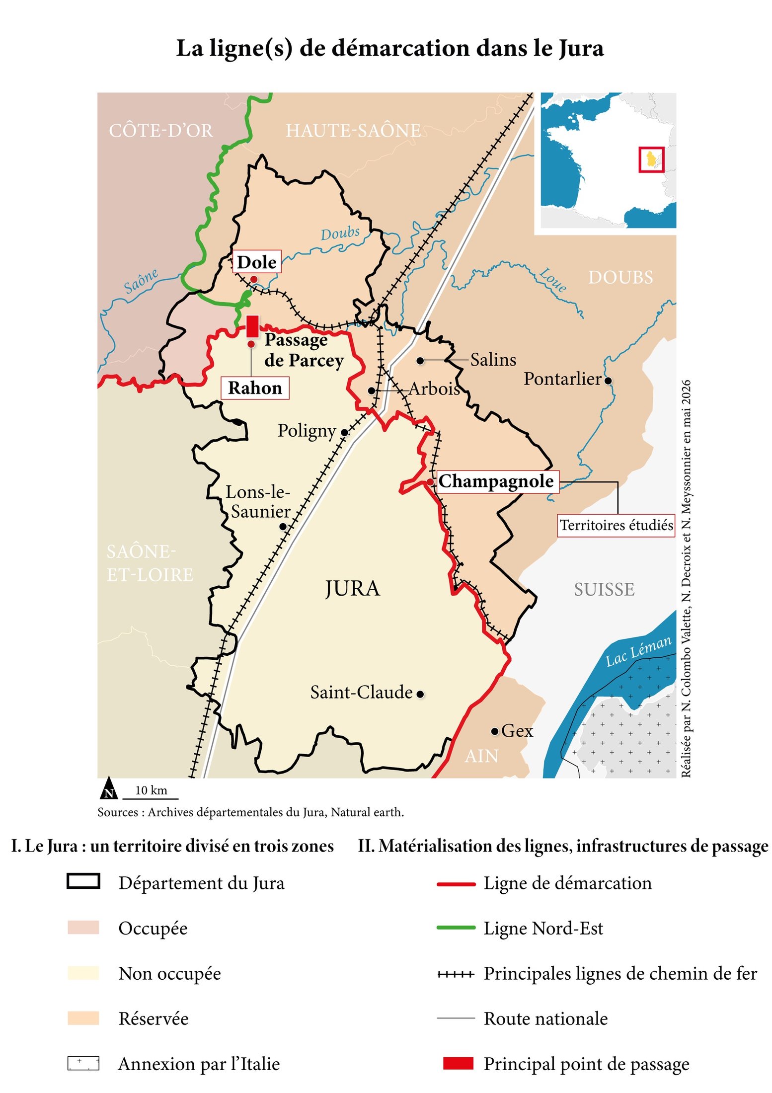
The demarcation line(s) in the Jura

A series of three maps produced as part of Nathan Colombo Valette’s Master’s degree in Contemporary History, focusing on the topic “A department at war: towards a sensitive history of the demarcation line in the Jura (1940–1944)”.

This work comprises a general map providing context, as well as two maps detailing specific situations relating to the demarcation line. They enable the precise location of the various routes, crossing points and areas where the line extends or overlaps across several departments, in order to support and illustrate the student’s argument.

Learn more

Map: global hyperconnectivity

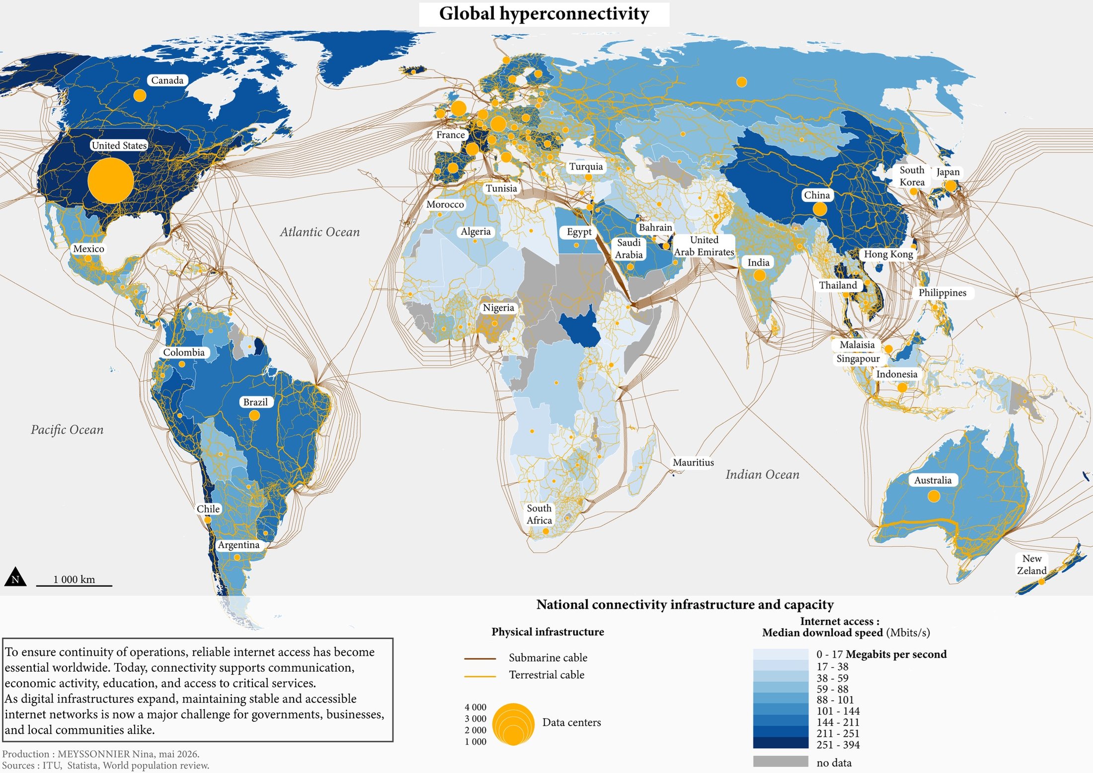
How is the world connected?

Today, internet access has become essential to the functioning of the world. It enables the exchange of information, economic development, communication, and access to essential services.

Thanks to digital infrastructure and communication networks, societies are becoming increasingly interconnected. However, ensuring stable and fast internet access remains a major global challenge.

Map: Milan Olympics ice dancing

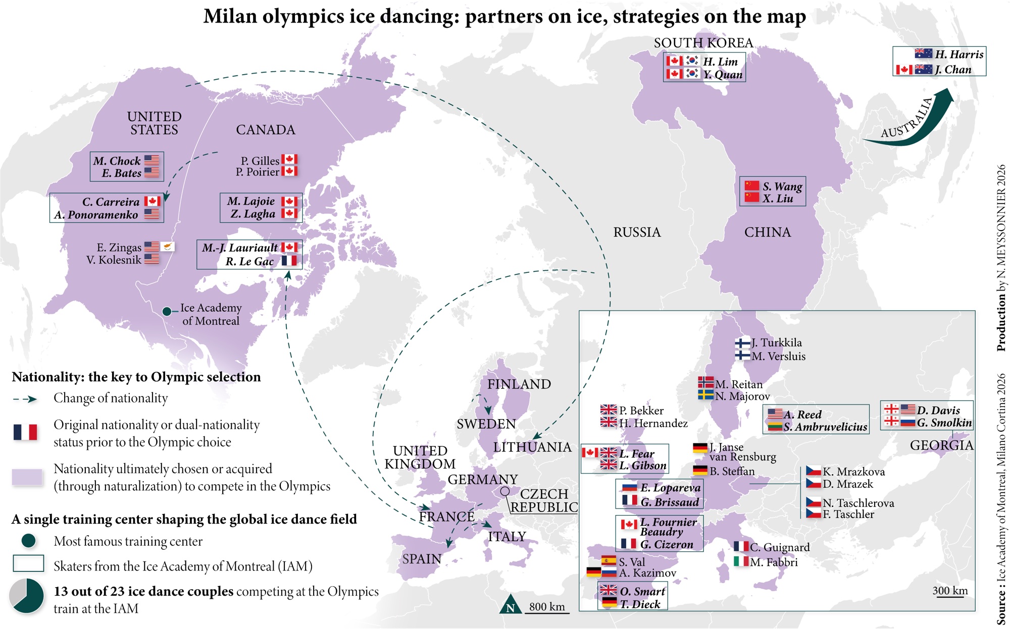
Milan Cortina 2026 Winter Olympics

This map on ice dancing shows how some skaters change nationality to increase their chances of selection, and how couples cluster around a few major training centres.

Learn more

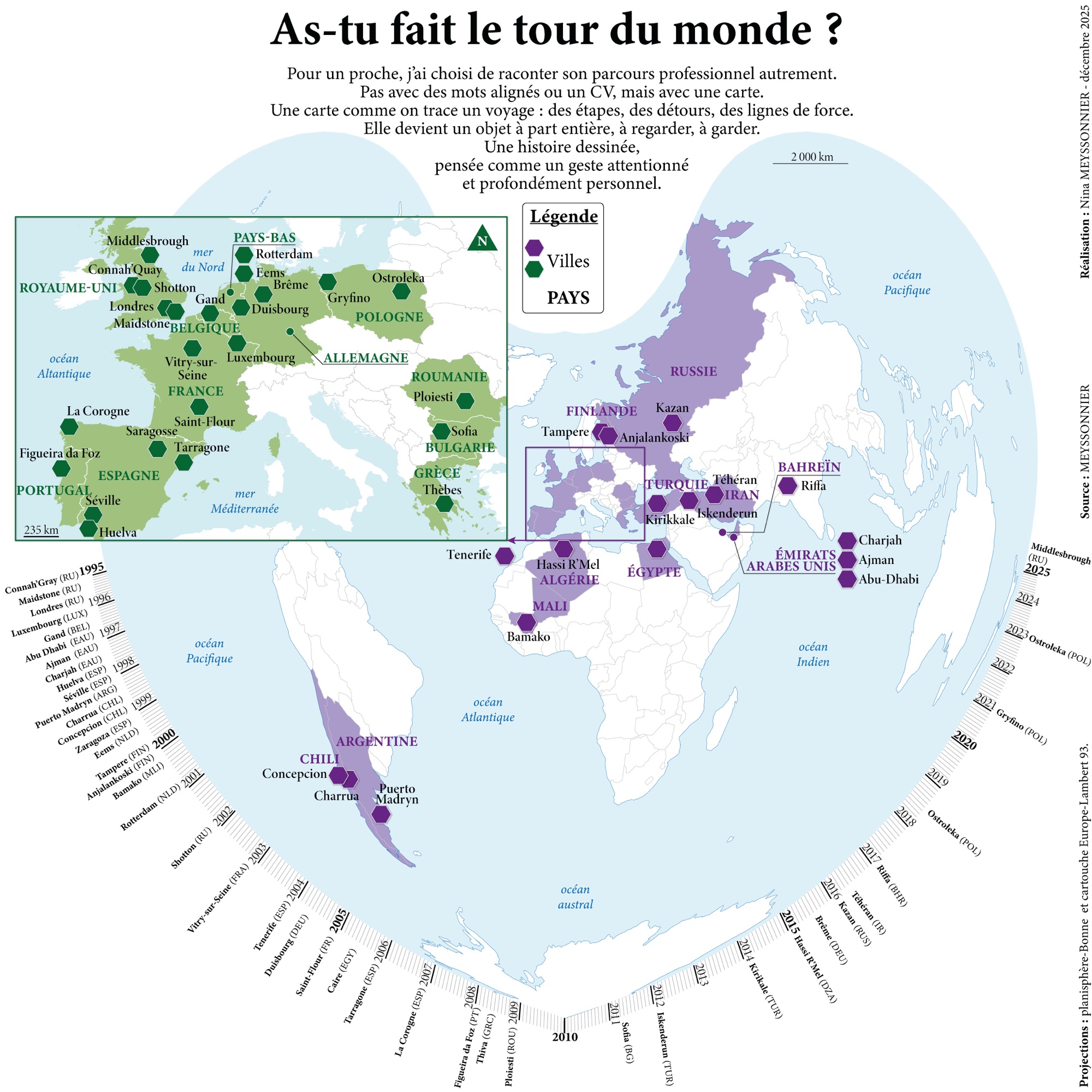
Map: a mapped-out career path

A mapped-out career path

An anonymised example of a map that tells a career path as a journey, with its stages and turning points. This is not the final project.

Learn more

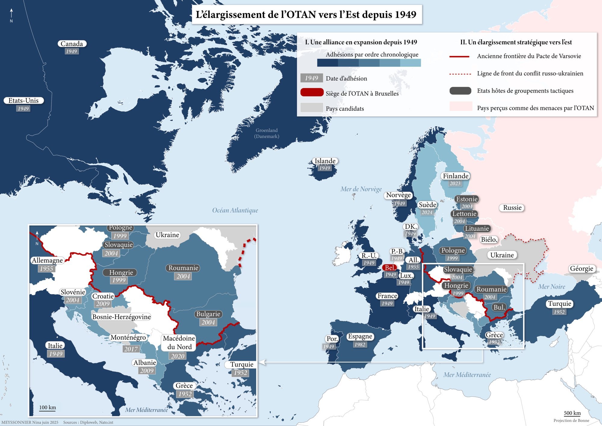
Map: NATO’s eastward expansion since 1949

The expansion of NATO since 1949

This map traces the successive waves of enlargement of the North Atlantic Treaty Organisation (NATO) since its creation in 1949 by the twelve founding states. It first shows the Alliance’s establishment in Western Europe during the Cold War, in the face of the Soviet bloc.

It then highlights the gradual expansion into Central and Eastern Europe after 1991, with the major waves of enlargement in 1999 and 2004. The recent accessions of Finland (2023) and Sweden (2024), decided following Russia’s invasion of Ukraine, illustrate the strategic realignment of the continent.

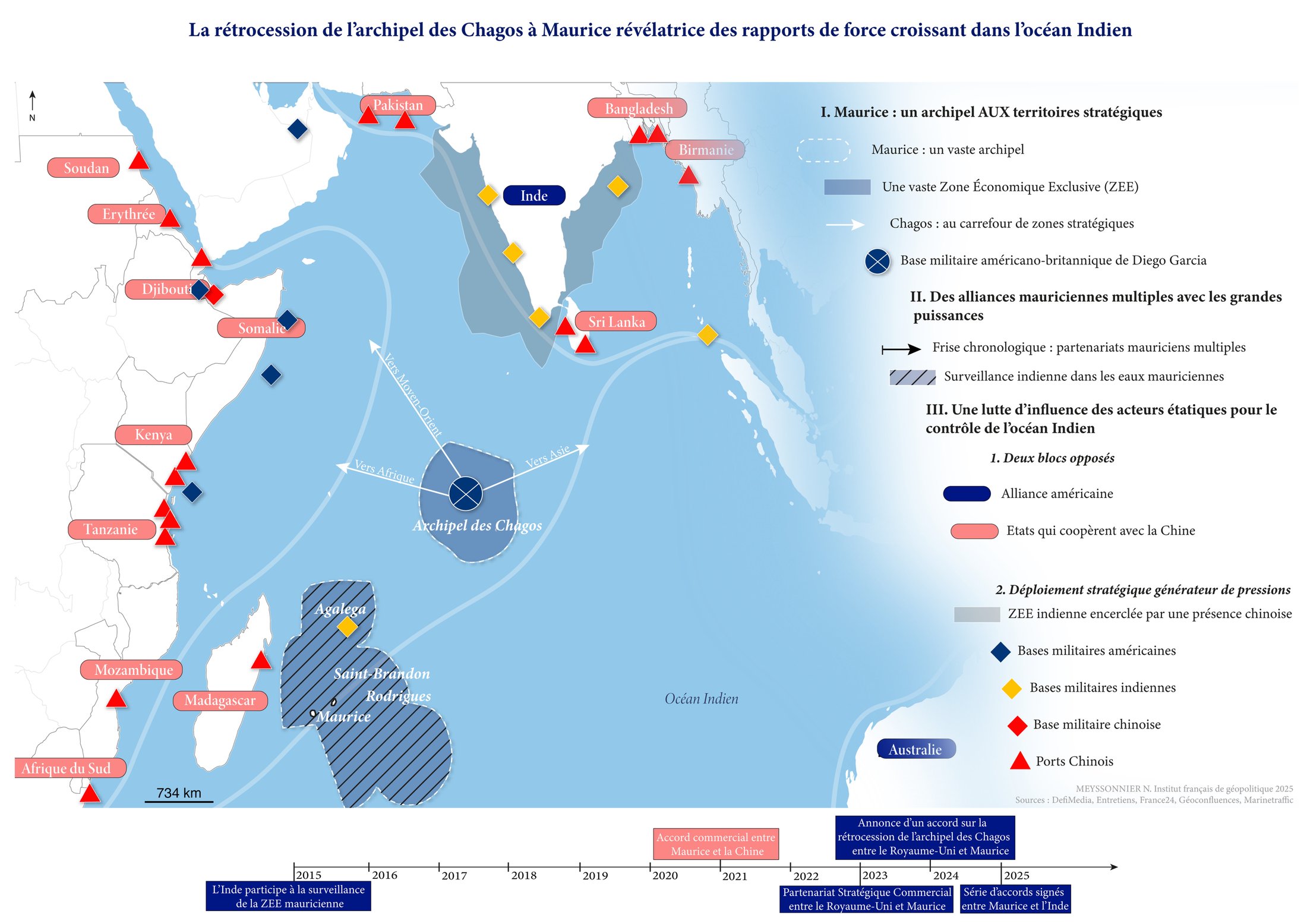
Map: the return of the Chagos Archipelago to Mauritius, revealing the balance of power in the Indian Ocean
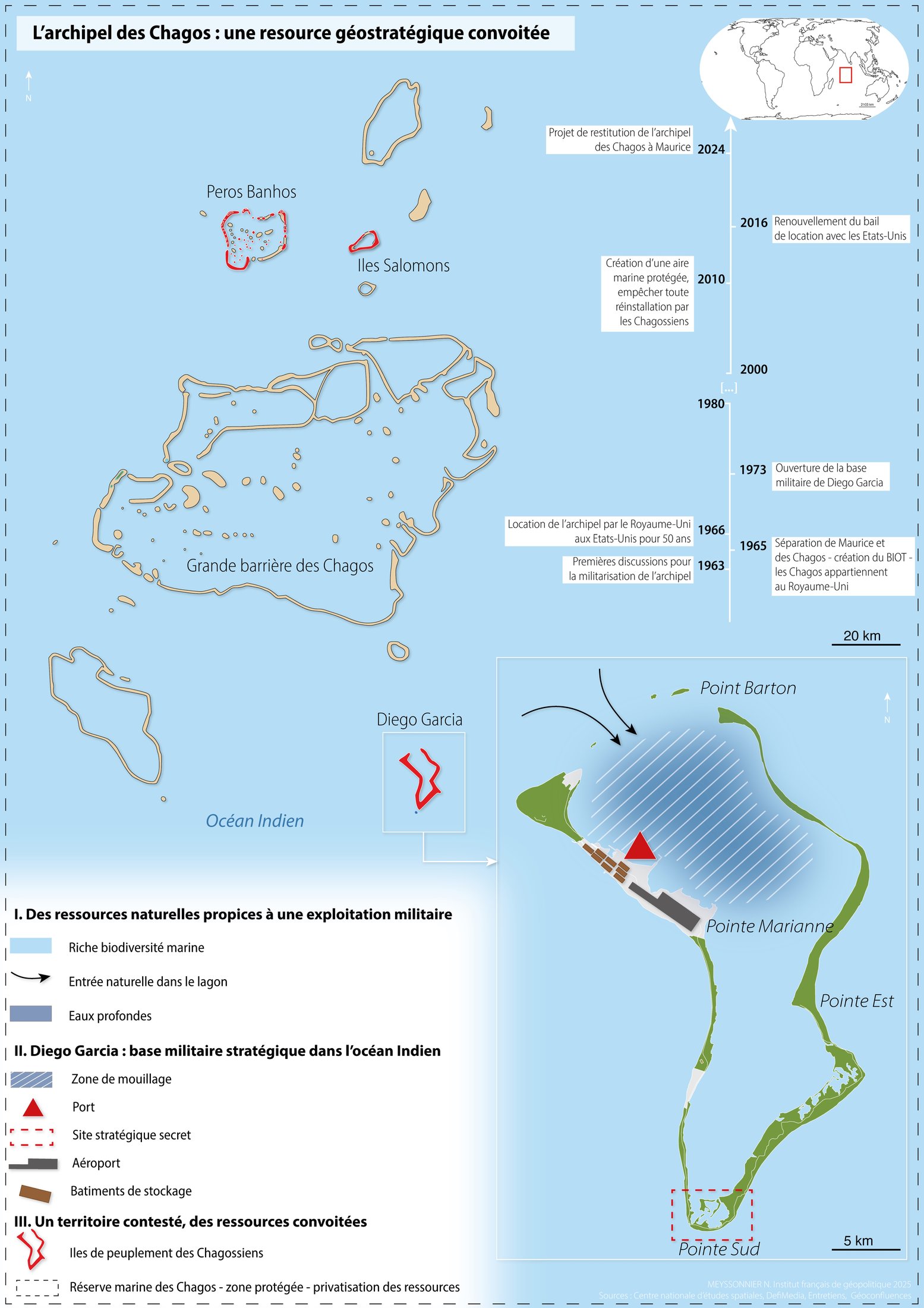
Map: the Chagos Archipelago, a coveted geostrategic resource

The return of the Chagos Archipelago

This dissertation analyses the return of the Chagos Archipelago, which was separated from Mauritius by the United Kingdom in 1965, from the Mauritian perspective. It places this sovereignty dispute within the context of the 2024 general election, at a time when the issue is becoming a major domestic and diplomatic concern.

It highlights the balance of power shaping the Indian Ocean, between Western powers, India and China. It also explains why the archipelago is so coveted: its central location, its vast maritime zone and the US military base at Diego Garcia make it a key strategic foothold.

Learn more

Interactive maps

The death penalty in the United States

Interactive map.

Open full screen

Seaside holidays in western France: how much does it cost?

Interactive map produced on 3 June 2026 for Ouest-France.

Link to the article

Liberté 250: the Patrouille de France’s mission to the United States

Interactive map produced on 4 May 2026 for Ouest-France.

Link to the article

Maine-et-Loire: the pumping station protecting 60,000 people from flooding

Map produced for Ouest-France.

Link to the article